
Climascapes
Climascapes is a platform allowing students, architecture studios, researchers and governments to explore and create nature based solutions.
Collaboration
- Bianca Andaloro
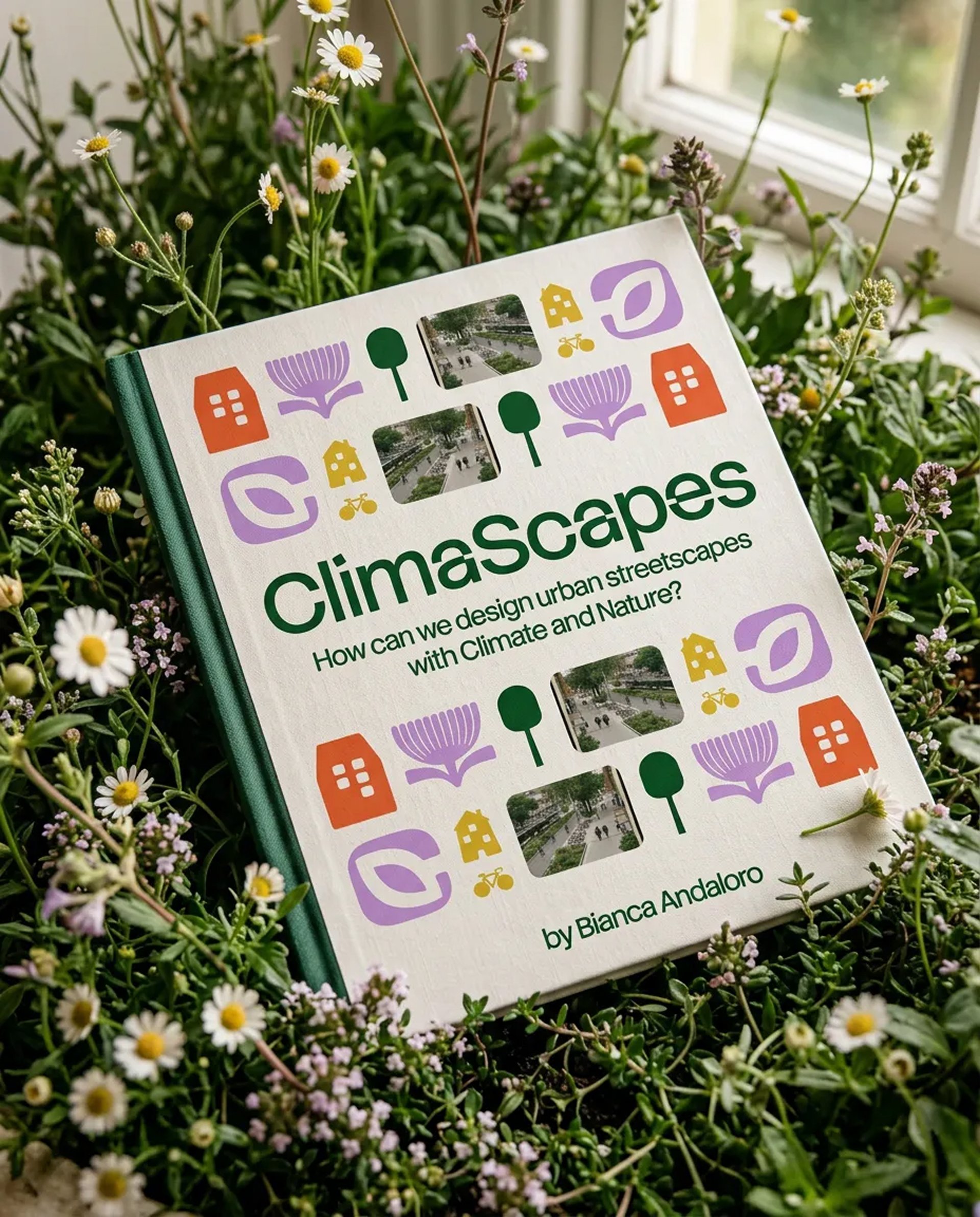
NatureCityLAB came to me with a research problem and a book in progress. They had spent years at the University of Basilicata studying how cities adapt to climate change through Nature-based Solutions — the planted swales, permeable pavements, micro-forests, and water plazas that quietly do the work of regulating temperature, managing rainfall, and restoring biodiversity in places that used to be asphalt. Funded under Italy’s PNRR Tech4You programme (and through that, the EU’s NextGenerationEU), the lab — led by Prof. Ina Macaione, with Dr. Bianca Andaloro and Dr. Alessandro Raffa as the researchers I’d work with most closely — was preparing two parallel artifacts from the same body of work: a printed monograph from FrancoAngeli, and a digital platform that could translate the research into something practitioners, students, and city governments could actually use.
My brief was the second one: the brand, the platform, the build.
A name and a mark
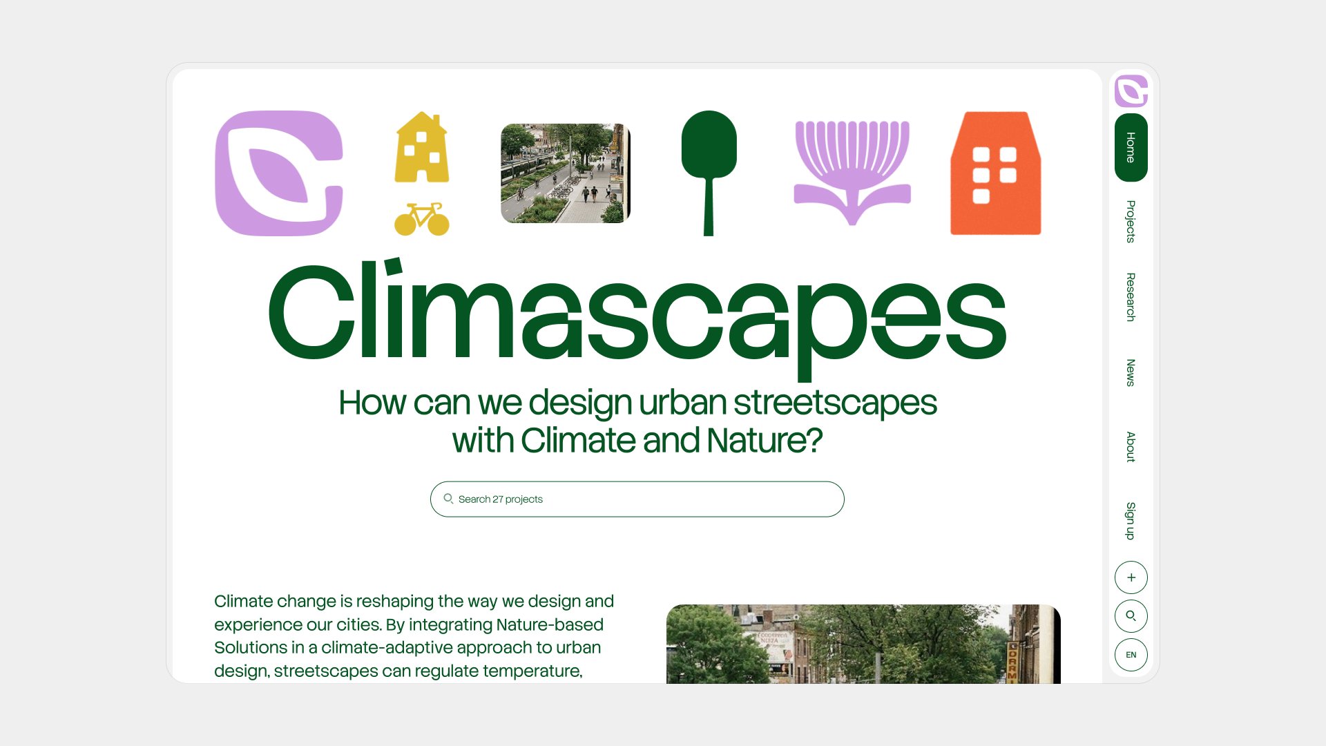
The identity work began with the word. ClimaScape — the lab’s own coinage for a climate-adaptive streetscape — was the editorial centre of gravity, and I wanted the visual system to treat it that way: less a brand than a term of art, the kind of mark you’d expect to see on the spine of a university press monograph rather than a startup hero.
The wordmark sits in a restrained sans, paired with the Stack Sans family across the editorial system and Geist Sans/Mono for interface and structured content. Tight tracking, no decorative flourish, no horticultural pictograms-as-letterforms. The logomark is the one bit of warmth in the typographic system: a soft C wrapped around a stylised leaf, drawn in the brand’s accent purple rather than the inevitable green of sustainability design. The base palette stays close to nature — a deep forest green carries text and UI — but the accent colours (purple, gold, lime) push away from the photosynthetic monoculture of the genre.
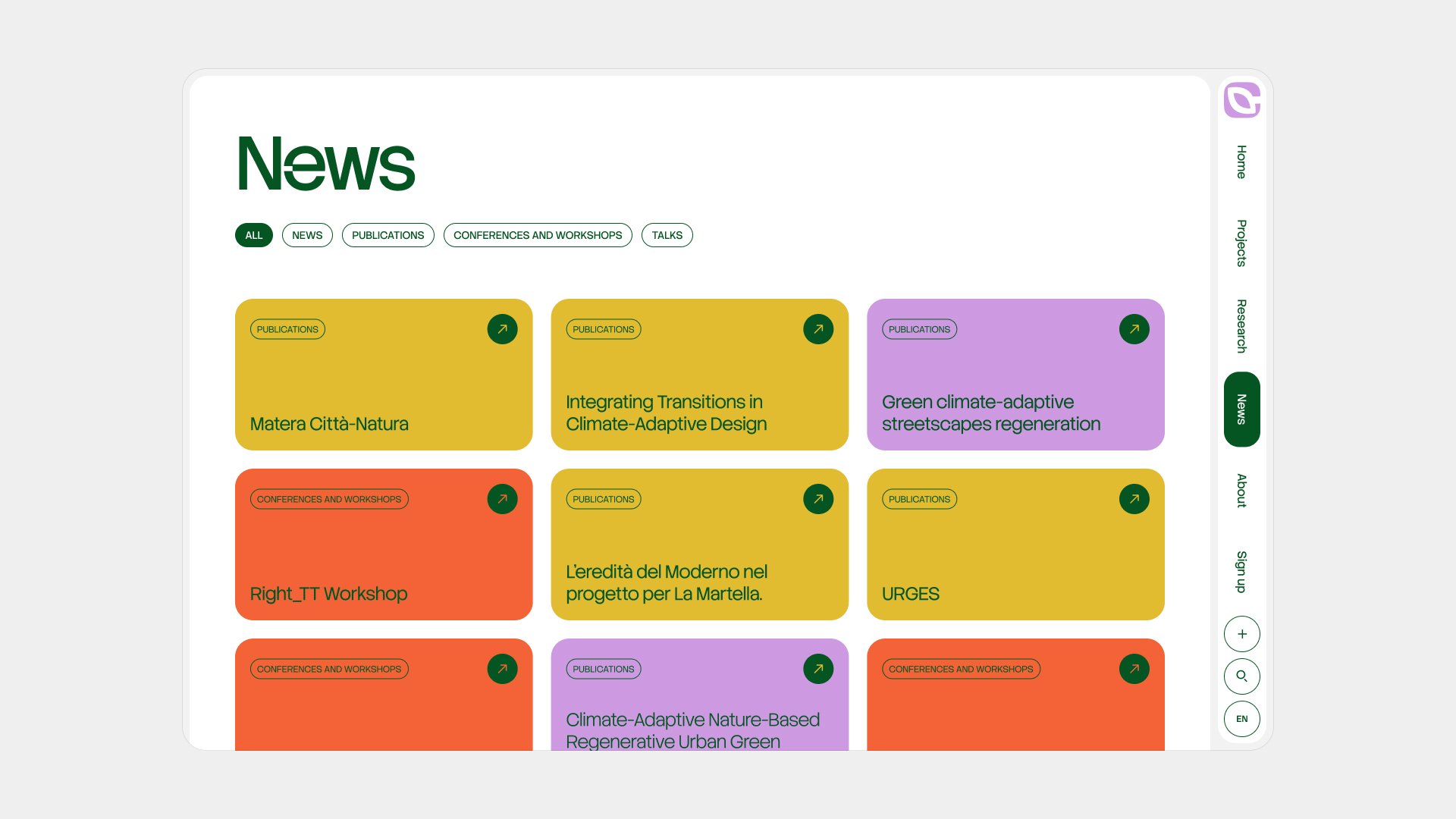
The homepage banner does the warmer work. Rather than reach for photography of trees-in-concrete — a category of stock image that’s become its own visual cliché — I drew a small set of illustrative icons from the project’s own vocabulary: trees, flowers, buildings, bicycles, the logomark itself. They animate together in a grid at the top of the page, doing the job a hero image usually does without committing the platform to a single aesthetic register.
Two languages, one taxonomy
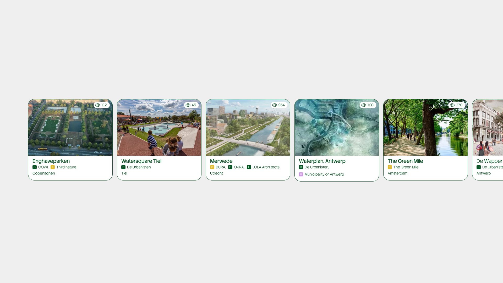
The hard problem was structural, not visual. NatureCityLAB had developed their own classification system — the CANBUR methodology, mapping projects against contextual vulnerabilities, Nature-based Solutions, spatial devices, and transformative actions. The kind of multi-axis taxonomy researchers love and interfaces, in my experience, tend to hate. Strip it down and you undermine the research; leave it intact and you produce a filter sidebar nobody uses.
The compromise was to let the methodology drive the data, but not the navigation. Every project is tagged exhaustively against the framework in Payload, the headless CMS underneath the platform, but the front of the site offers a handful of clear entry points — by place, by studio, by what the project actually does — and surfaces the rest through search. The studio index, an alphabetical roll of contributing practices from De Urbanisten and EFFEKT to the city of Copenhagen, is its own browsing surface.
Italian and English ship together at the database level, not as a translation layer bolted on top of an English-first product. The lab works in Italian, the field publishes in English; both languages get equal weight in URLs, the editorial system, and the way news, publications, and projects are filed. Per-locale fields in the CMS mean someone writing in Italian and someone reading in English see the same project, structured the same way, written in their language by a person who actually speaks it.
A map that takes climate seriously
A platform about climate-adaptive design without a map would be a strange thing. The map is the spine of the project explorer — MapLibre under the hood, base tiles from MapTiler, project markers clustered with Supercluster so the view stays legible at every zoom level.
The bit I’m proudest of is the climate overlay. The lab wanted users to be able to read projects against the conditions they were designed for — to see, for instance, that a water plaza in Rotterdam sits in a different rainfall regime than a heat-mitigation street in Athens. So the map can layer in NASA GIBS climate data — surface temperature, vegetation index, cloud fraction, aerosol depth — as adjustable WMS tiles, with opacity and date controls. It’s the kind of feature that sounds simple in a sentence and takes a while to make feel effortless; the result is that a researcher or a city planner can pull up a project and see the climate it was designed inside, not just where it is on a map.
Submitting a project
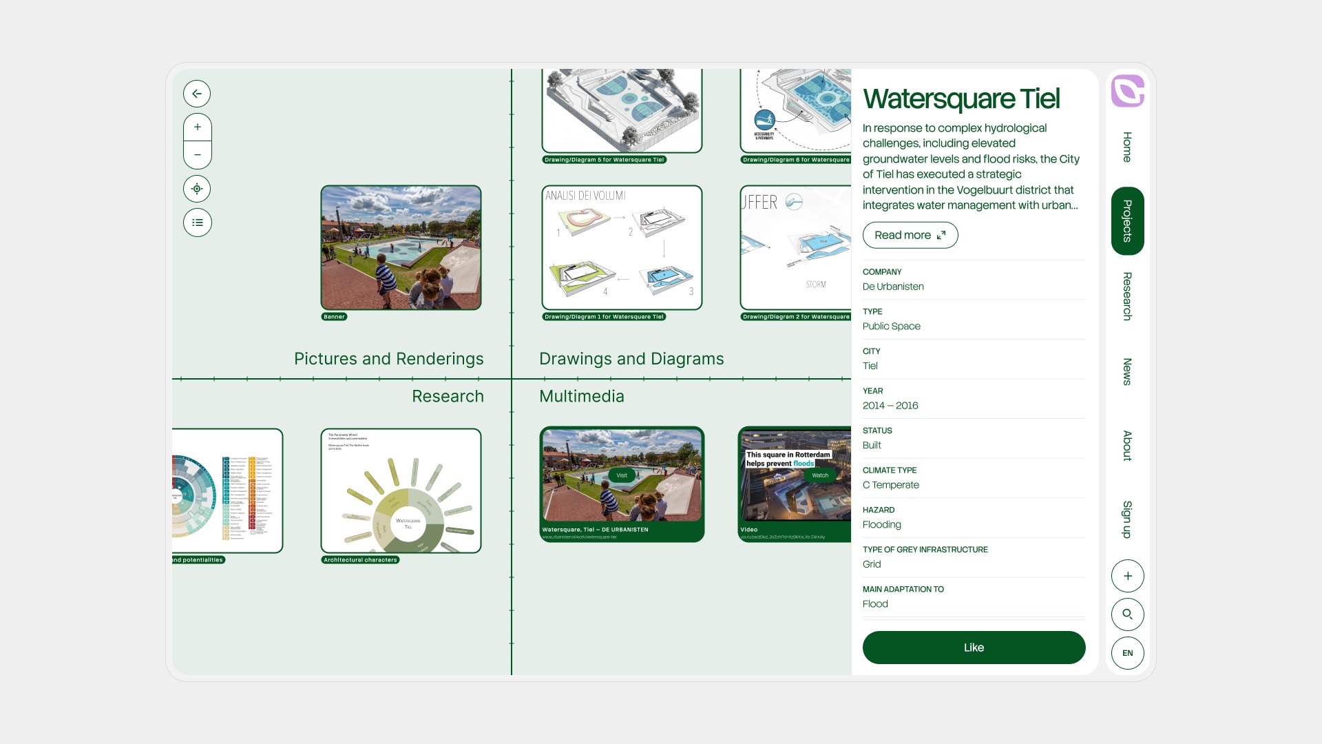
The platform is alive in the sense that it grows. Anyone — researcher, studio, municipality — can sign in (passwordless, magic-link email; no password to forget) and contribute a project through a ten-step guided wizard: basics, location, project details, description, canvas drawings, photography, the AbS Abacus (the lab’s grid for mapping spatial devices against project elements), and multimedia. Drafts persist in session storage, so the wizard survives a refresh; on submit, the project goes live and the contributor gets a notification — and, the first time, a celebration email.
Activity flows back through a notification centre and a weekly digest, compiled by a cron job that summarises what’s new across the platform and lands in members’ inboxes once a week. Quiet, low-volume, easy to ignore — the cadence of a research platform, not a social network.
What shipped
Climascapes launched live at climascapes.com, bilingual, with a starting set of projects, news, publications, and the research methodology in full. It runs on Next.js and Payload, hosted on Vercel, and sits alongside the lab’s companion volume — ClimaScapes. Designing with Climate Adaptation in Streetscapes by Bianca Andaloro, published by FrancoAngeli in 2026 — both growing out of the same research, in different registers.
Thanks to Prof. Ina Macaione, Dr. Bianca Andaloro, Dr. Alessandro Raffa, and Arch. Giovanna Izzi at NatureCityLAB for the trust, the rigour, and a brief that genuinely had something to say.